


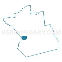
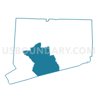
Orange 1 Voting District, New Haven County, Connecticut
About
Outline

Summary
| Unique Area Identifier | 550032 |
| Name | Orange 1 Voting District |
| County | New Haven County |
| State | Connecticut |
| Area (square miles) | 8.79 |
| Land Area (square miles) | 8.73 |
| Water Area (square miles) | 0.06 |
| % of Land Area | 99.29 |
| % of Water Area | 0.71 |
| Latitude of the Internal Point | 41.29525130 |
| Longtitude of the Internal Point | -73.01967660 |
Maps

Graphs
Select a template below for downloading or customizing gragh for Orange 1 Voting District, New Haven County, Connecticut


Neighbors
Neighoring Voting District (by Name) Neighboring Voting District on the Map
- Derby 114 Voting District, New Haven County, CT
- New Haven 26-01-10-92 Voting District, New Haven County, CT
- Orange 2 Voting District, New Haven County, CT
- West Haven 12 Voting District, New Haven County, CT
- West Haven 6 Voting District, New Haven County, CT
- Woodbridge 1 Voting District, New Haven County, CT
Top 10 Neighboring County Subdivision (by Population) Neighboring County Subdivision on the Map
- New Haven town, New Haven County, CT (129,779)
- West Haven town, New Haven County, CT (55,564)
- Orange town, New Haven County, CT (13,956)
- Derby town, New Haven County, CT (12,902)
- Woodbridge town, New Haven County, CT (8,990)
Top 10 Neighboring Place (by Population) Neighboring Place on the Map
- New Haven city, CT (129,779)
- West Haven city, CT (55,564)
- Orange CDP, CT (13,956)
- Derby city, CT (12,902)
Top 10 Neighboring Elementary School District (by Population) Neighboring Elementary School District on the Map
Top 10 Neighboring Secondary School District (by Population) Neighboring Secondary School District on the Map
Top 10 Neighboring Unified School District (by Population) Neighboring Unified School District on the Map
- New Haven School District, CT (129,779)
- West Haven School District, CT (55,564)
- Derby School District, CT (12,902)
Top 10 Neighboring State Legislative District Lower Chamber (by Population) Neighboring State Legislative District Lower Chamber on the Map
- State House District 116, CT (24,841)
- State House District 117, CT (23,367)
- State House District 114, CT (22,623)
- State House District 92, CT (21,933)
Top 10 Neighboring State Legislative District Upper Chamber (by Population) Neighboring State Legislative District Upper Chamber on the Map
- State Senate District 10, CT (96,843)
- State Senate District 17, CT (95,979)
- State Senate District 14, CT (92,977)
Top 10 Neighboring 111th Congressional District (by Population) Neighboring 111th Congressional District on the Map
Top 10 Neighboring Census Tract (by Population) Neighboring Census Tract on the Map
- Census Tract 1541, New Haven County, CT (8,070)
- Census Tract 1201, New Haven County, CT (6,721)
- Census Tract 1574, New Haven County, CT (4,206)
- Census Tract 1572, New Haven County, CT (3,837)
- Census Tract 1601, New Haven County, CT (3,443)
- Census Tract 1573, New Haven County, CT (3,310)
- Census Tract 1411, New Haven County, CT (2,777)
- Census Tract 1571, New Haven County, CT (2,603)